Lagoon Mapping
If you are uncertain about the amount of solids you have in your lagoon then it is time to have your lagoon mapped.
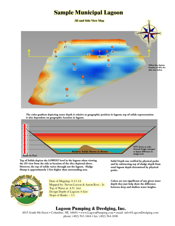
Lagoon Pumping uses sonar technology and records the depth every 3 feet. We bring this meta data back to our offices and input it into our proprietary mapping software and we get detaild contour and 3D maps showing the lagoons water depth. We then calibrate the data with physical probes of the lagoon. We input the measured lagoon depth against the water depth; then we run an algorithm on the data so we can extrapolate the depth of the solids.
You can see the type of maps that we deliver below.
Lagoon Pumping & Dredging, Inc.
For information, quotes and sales: Call the representative for your area:
North East: NE, SD, IA, N-MO, NE-KS: (402) 270-1366 (Brian Jakub)
South West: W-TX, NM, W-OK, CO, WY, MT, W-KS: (763) 355-4099 (Steve Larson)
South East: E-TX, E-OK, S-MO, SE-KS, LA, MS, AR (405) 406-7979 (Jason Lee)
Main Office: (402) 563-3464 (Accounting, Emergencies, Management)


